Merrimack Conservation Commission
6 Baboosic Lake Road Merrimack, NH 03054
Office Hours:
Monday-Friday 8:00am-4:30pm
(603) 424-3531
Email
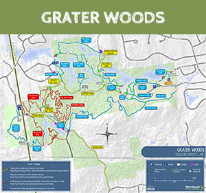
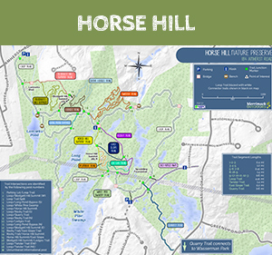
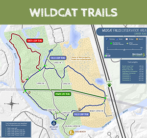
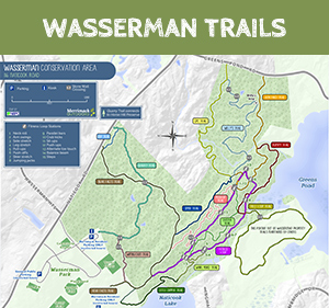
Access our GIS Trail Maps below:Website access on your computer via your usual web browser